
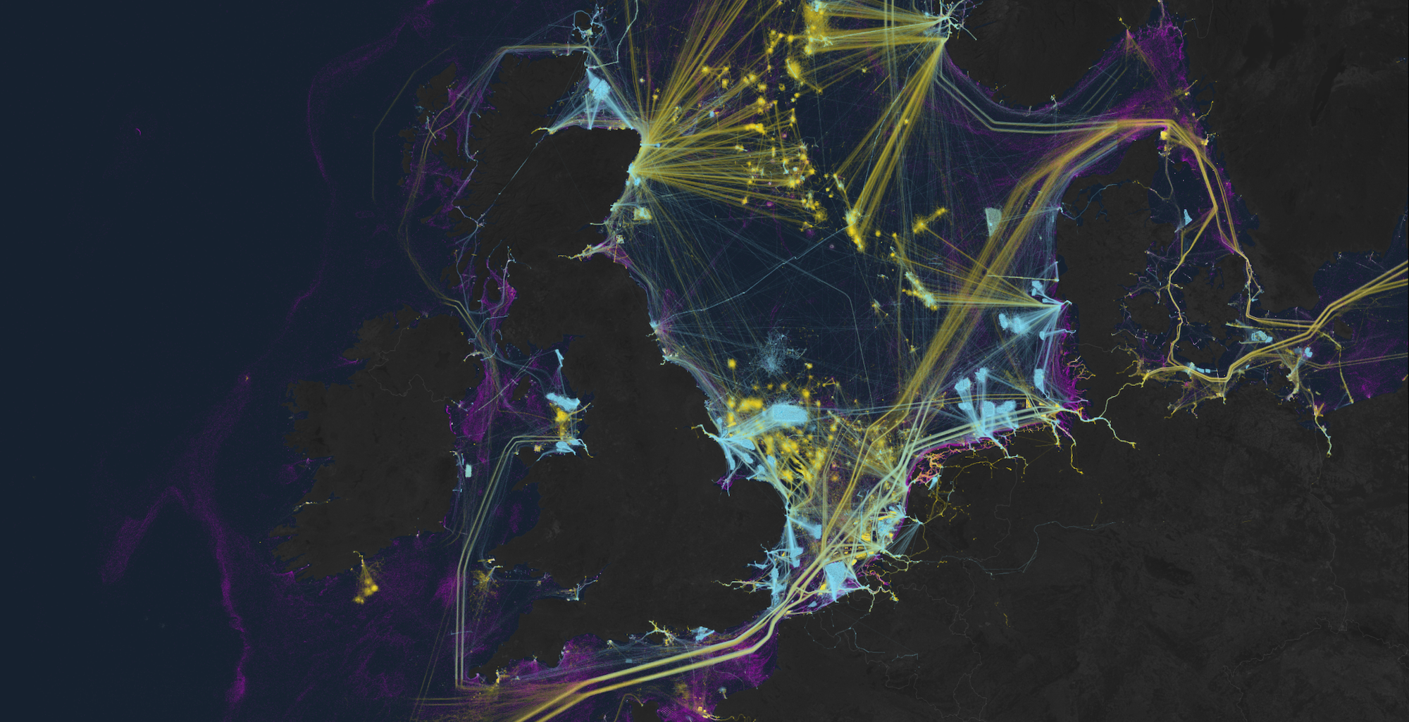
For an unprecedented exploration of humanity’s impact on and connection to our oceans, researchers now have the ability to utilize artificial intelligence to analyze global satellite imagery archives. This innovative project, managed by Global Fishing Watch, a nonprofit supported by Google that monitors maritime activities, is extensively detailed in an article published in Nature on January 3. Leveraging advancements in machine learning technology, the study reveals previously unseen effects on marine ecosystems.
The groundbreaking research highlights the existence of “dark ships,” a term commonly used to describe a significant number of maritime vessels that operate without transmitting their locations. As per Global Fishing Watch’s announcement, up to 75% of all commercial fishing vessels operate “under the radar,” hidden from public scrutiny.
Traditionally, maritime watchdogs have relied on the Automatic Identification System (AIS) to track ships’ radio signals worldwide, although this method has its limitations, as reported by The Verge. Due to varying AIS requirements across nations and vessels, it is relatively easy for a crew to evade detection by simply turning off the ship’s transponder, leading to the existence of these elusive “black fleets.”
An analysis reveals that a staggering 75% of commercial fishing vessels globally operate without regular tracking, with a concentration of such activities in regions like South Asia and Africa. This data underscores the significant impact of human activities at sea and the need to address these blind spots, as highlighted by International Fish Watch.
To address this data gap, researchers gathered 2 million gigabytes of satellite imaging data from the Sentinel-1 satellite constellation operated by the European Space Agency between 2017 and 2021. Unlike AIS, the sophisticated radar systems of the ESA satellites can detect maritime activities irrespective of cloud cover or time of day.
By cross-referencing this data with GPS information, researchers were able to identify previously undetected fishing vessels that had eluded traditional tracking methods. The application of machine learning algorithms to these vast datasets uncovered the true extent of the impact of these clandestine vessels on a global scale.
Contrary to previous assumptions, the research findings reveal a disproportionate concentration of fishing activities in regions like Asia, as opposed to Europe. This newfound transparency sheds light on the dominance of Asian waters in commercial fishing, challenging the conventional narrative of equal fish distribution between continents.
Moreover, the study also highlights positive trends, such as the significant growth in onshore renewable energy projects over the study period. China, in particular, demonstrated remarkable progress by expanding its wind farm capacity by 900% by 2021, surpassing the number of oil platforms with wind turbines.
This study marks a significant milestone in ocean management and transparency, offering free access to this valuable monitoring data for all countries, as emphasized by David Kroodsma, the director of research and technology at Global Fishing Watch.